NSW Maps
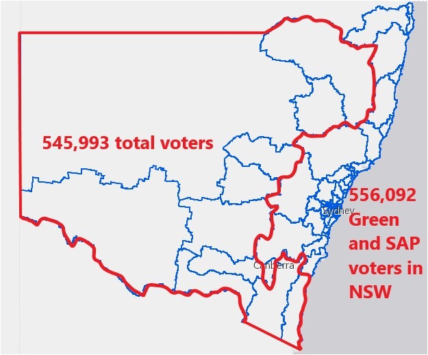
In the 2023 State election 556,092 people voted for The Greens and the Sustainable Australia Party; the vast majority of these in the Metropolitan and North Coast areas. There are a total of 545,993 voters in the eleven marked electorates.
There are more Green and SAP voters in N.S.W. opposed to the irrigation, timber, and other natural resource-based industries than there are voters west of The Great Dividing Range, and Monaro and South Coast.
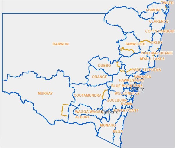
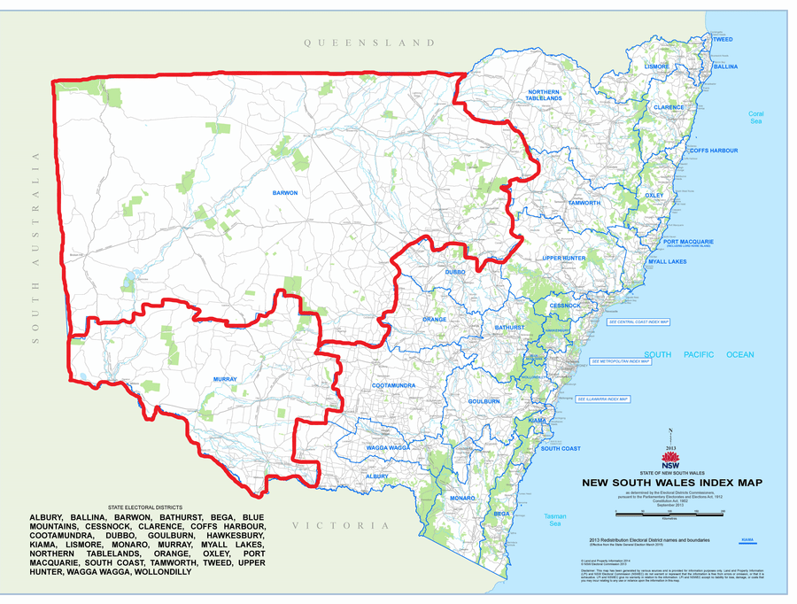
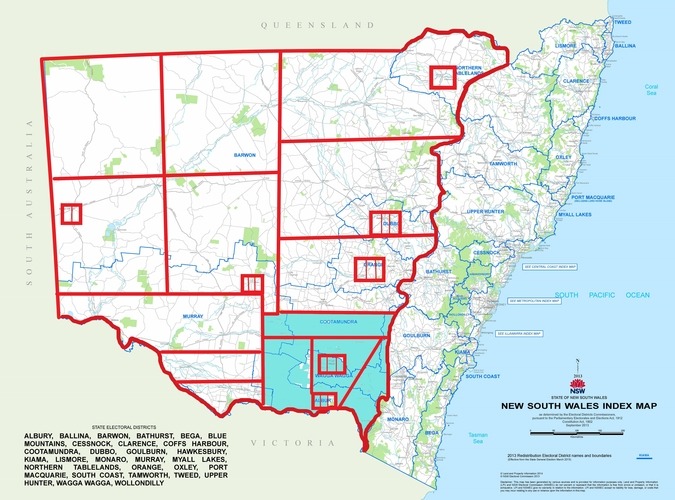
NSW was subject to an electoral redistribution after the 2019 State election. Five of the eight country electorates west of The Great Dividing Range increased in area to bring their populations within five percent of the State average. These electorates are Murray, Cootamundra, Bathurst, Dubbo and Northern Tablelands. These increases are displayed by the previous boundaries in yellow compared to the new boundaries in blue.
These enlargements are a continuation of the trend since the year 1904 for one country electorate to be absorbed into the increasing Newcastle, Sydney and Wollongong urban area every five years.
Video of maps illustrating the need for a Riverina State.
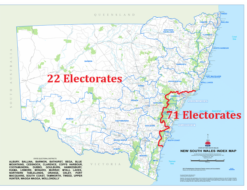
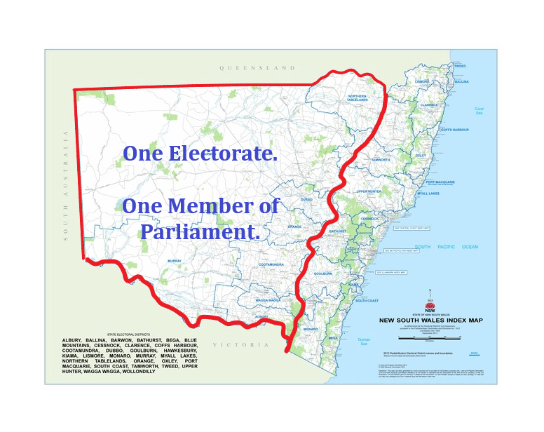
The map above outlines the seventy one N.S.W. State electorates in the Newcastle, Sydney and Wollongong areas compared to the twenty two in the remainder of N.S.W. as at 2019. This illustrates the concentration of political power in the Newcastle, Sydney and Wollongong areas.
The number of Green voters is the equivalent of every voter in eight and one half electorates. There are only eight electorates and 398,000 voters west of the Great Dividing Range. There are more people who vote for the Greens than there are voters west of the Great Dividing Range.
This map illustrates the relative political powerlessness of the people reliant on irrigation, forestry and mining.
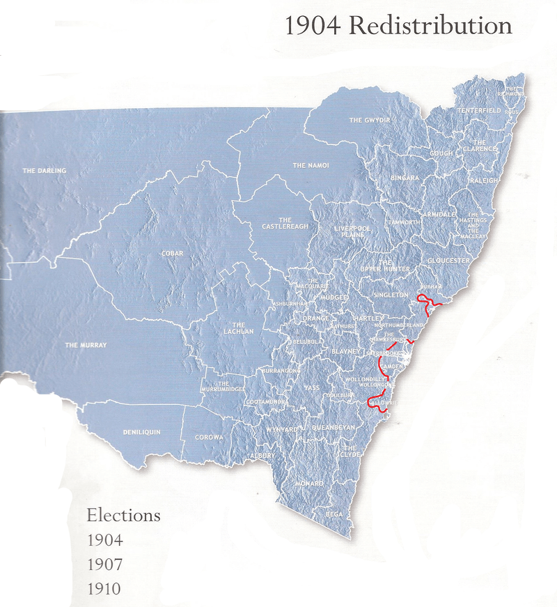
The map above displays the electorates in the first state election in 1904.
The area of the current electorate of Barwon contained six electorates in 1904. The current area of Murray contained two, Albury contained two, and Cootamundra five.
On average, one electorate has evaporated from the non-metropolitan area and condensed into the metropolitan area every 5 years. If this long term trend continues, in forty years time, there will be only one electorate west of the Great Dividing Range.
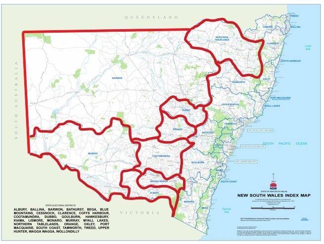
The above map is the forecast one electorate west of the Great Dividing Range in between forty to seventy years’ time.
The map above outlines the electorates of Barwon containing 47% of the area of the state, and Murray containing 13%. These two electorates contain 60% of the area of the state, and the vast majority of the irrigation. These electorates contained 97,000 voters in the 2019 State election.
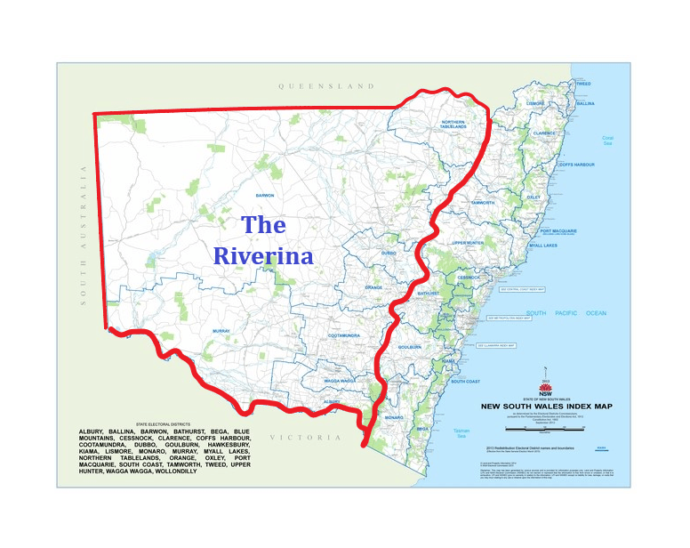
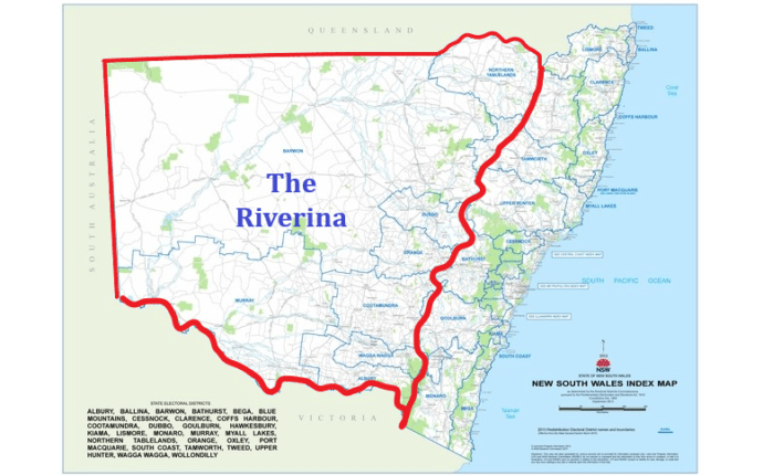
The map above outlines the potential area of The Riverina State. It may be larger.
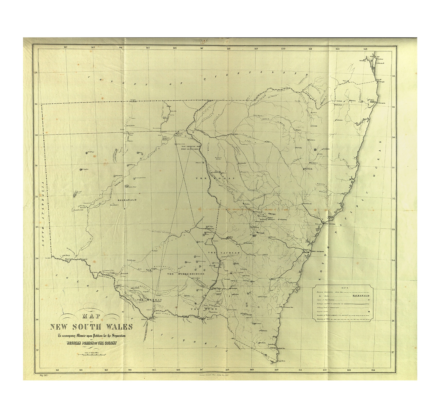
Above is the map of the Riverine District from the petitions of 1863 and 1865 to form a Riverine Colony.
.
The map above displays the approximate boundaries of electorates in The Riverina using area as the primary qualification. Electorates are limited to being no bigger than 10% of the area of the state, with additional electorates for every 10,000 voters, with electorates limited to no more than 10 in 10% of the area of the state.
The smaller electorates are the cities of Albury and Wagga with an additional three, Griffith and Leeton with three, Broken Hill with two, and Deniliquin and Moama with one.
The purpose of area qualifications is to ensure effective political representation for people in all areas of the state, and to prevent a concentration of political power and consequent domination in one area or city of the state, to the detriment of the people in the remainder, as is the case in N.S.W.
The coloured south east 10% of the area of the state is limited to ten electorates. This is ten of a total of twenty seven electorates displayed, being 37% of the total.
While some people in these electorates may be tempted to be aggrieved by this limitation, this same area comprises the two N.S.W electorates of Albury and Wagga, with 2.2% of the members of the N.S.W. Legislative Assembly. This is far less than the percentage in The Riverina state; and even this is certain to decrease further over time.