Millewa Group of Forests Timber Policy
Commercial Forestry in the Millewa Group of Forests
(Millewa, Moira and Gulpa forests)
The Millewa group of forests cover approximately 42,000 hectares of land to the immediate east of Mathoura and north of the Murray River. These forests have always been the property of the NSW Government, which has issued various styles of lease since British settlement.
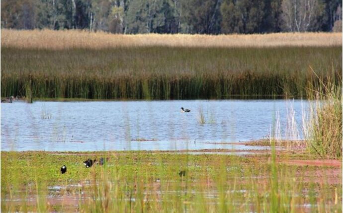
These forests are on relatively low-lying land and subject to regular flooding. This has generally prevented agricultural use, while providing a relatively hospitable environment for all local flora, particularly River Red Gums (Red Gums). These forests are currently widely populated with this tree.
Paradoxically, the pioneer maps and descriptions of the area do not display or mention the widespread Red Gum forests that exist today. Instead, they display and describe plains, reed beds and stands of Box trees (Charles Sturt – 1838, Edward Curr {Barmah} -1841, Townsend – 1848). Aerial photographs from as late as 1961 (Central Mapping Authority) display sparsely populated areas that are now heavy wooded. It is evident that the current widespread population of Red Gums has developed since British settlement.
Red Gum has been milled at Mathoura since the town’s earliest days, with both the Pastoral Times (Deniliquin) and Riverine Herald (Echuca) reporting in their publications on August 4th 1877 ‘… the Redbank (Mathoura) Sawmills where a large and flourishing trade is being done, supplying nearly the whole town of Deniliquin with Red Gum’.
In 2010, Arche Consulting, employed by the NSW Natural Resources Commission, reported that the timber industry based on the Millewa group of forests created $86,000,000 in annual direct and indirect regional output or business turnover, and created 450 direct or indirect jobs.
In 2010, considering The Greens party demand for ‘… a significant national park in Red Gum’, and appealing for The Greens party preference votes in the 2011 NSW election (The Nationals M.P. Andrew Fraser to the NSW Parliament), the NSW Labor government declared the Millewa group of forests the Murray Valley National Park, and consequently ended the timber industry based on these forests.
The closing down of this timber industry has immediately caused the unemployment and relocation of many people in this area. The stress and other emotional effects of this cannot be underestimated. The relocation of these people has consequently caused a decline in the quantity and quality of the remaining community and cultural options and activities.
The closing of this timber supply has necessitated the supply from other sources at an increased cost, which in the example of firewood and its attendant warmth, can have a serious health effect on the elderly and other vulnerable people, particularly in winter.
Considering,
1) The great increase in the quantity timber in these forests over many years as shown by the relatively sparse quantities recorded in the historical maps and descriptions compared to current quantities. (maps displayed below).
2) The history of local timber harvesting over the last 150 years and the self-replacing nature of this timber.
3) The great benefit and comfort the harvested timber provides for many Australians in the form of building and heating material, valued as $86,000,000 p.a. in 2010 (Arche Consulting).
4) The wealth and livelihood this harvesting provides directly for people employed in this industry, the vast majority being in the Mathoura, Deniliquin, Barham and Moama areas.
5) The community services, activities and associated employment and livelihoods created for the enjoyment of all people in these areas due to and depending on the timber harvesting industry.
And consequent to these considerations,
The Riverina State Group will re-enact the timber harvesting practises as of the year 2010, summarized as follows and further described in the attached NSW Code of Practise for River Red Gum Forests:
1) The forests be re-divided into the compartments surveyed prior to 2010.
2) Each compartment be available for harvesting in a rotation of 15-25 years depending on the quality of the timber in the relevant compartment.
3) Appropriate individual trees be selected for harvesting, considering especially,
a) inferior trees that will otherwise be naturally dominated by superior trees and eventually perish.
b) damaged trees that will not grow to normal potential and naturally eventually perish.
c) diseased trees that will not grow to normal potential and naturally eventually perish.
4) The quantity of these trees being approximately 30% of the commercial stock. Trees selected shall be as evenly distributed throughout the relevant compartment as possible. Clear felling i.e. complete felling of all trees in a compartment, is prohibited.
While protecting,
a) fauna habitat trees
and
b) recruitment trees.
The quantity of these trees being approximately 70% of commercial stock.
These forests will also be available for firewood collection at a suitably regulated quantity.
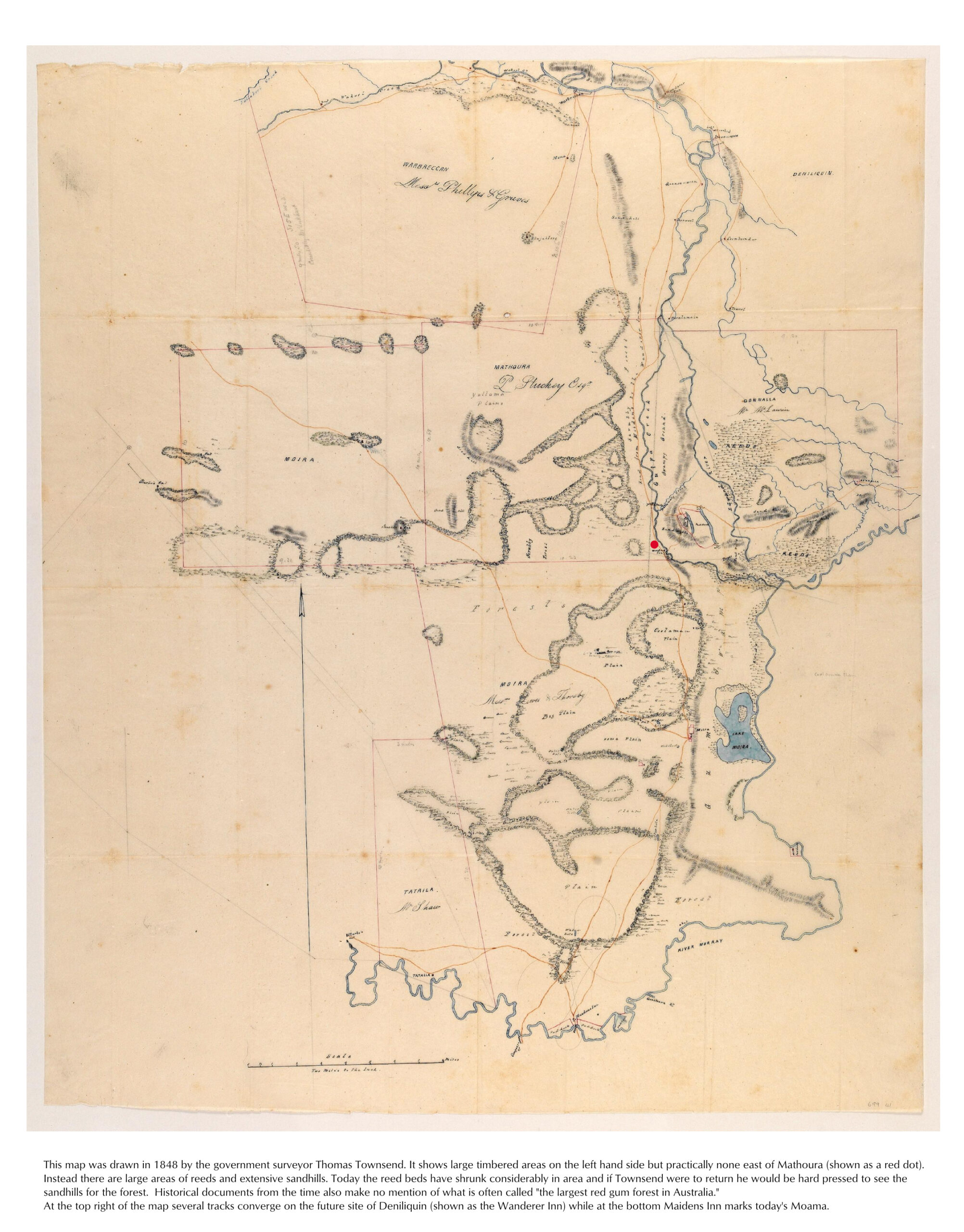
NSW State surveyor Thomas Townsend’s 1848 map of the Deniliquin-Moama region showing rivers, open plains and reed beds, but not widespread Red Gum forests.
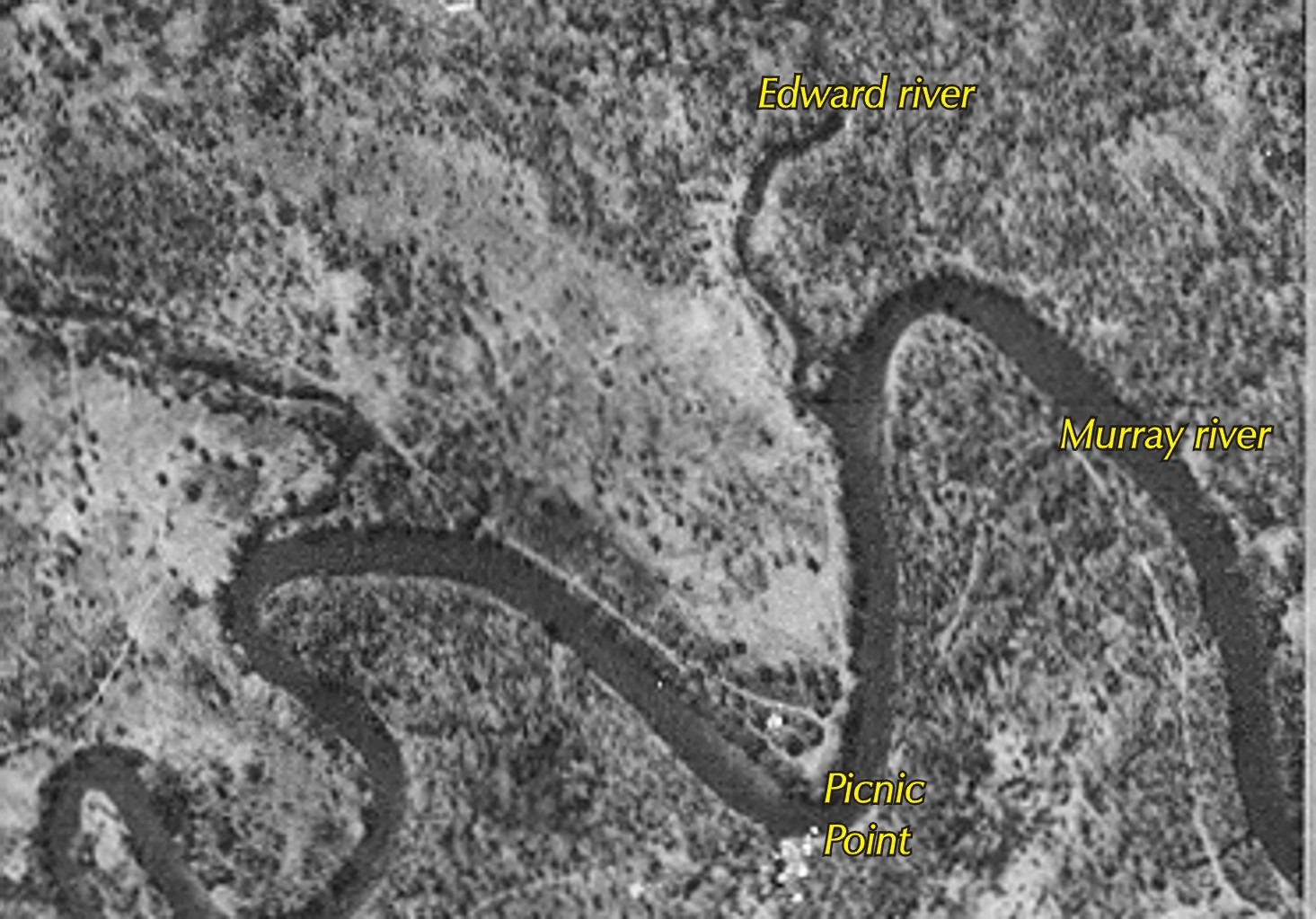
NSW Central Mapping Authority 1961 aerial map of the Edward River departure from the Murray River near Picnic Point (near Mathoura) showing the relatively sparsely forested area compared to current coverage.